
Business Details
50+ Years
experience
Leading Surveying Solutions in the UK & Ireland
KOREC Group has been a trusted provider of geospatial solutions since 1967, combining advanced technology with expert knowledge to serve the surveying, engineering, and construction sectors across the UK and Ireland. Founded as a family-run business, we have grown into a leading Trimble distributor, offering cutting-edge equipment such as GNSS systems, total stations, laser scanners, and mobile mapping solutions. Our commitment to innovation is reflected in our partnerships with industry leaders and our development of software platforms like Soarvo and FastMap. We prioritise customer success through comprehensive training, responsive support, and tailored consultancy services, ensuring clients can work smarter, faster, and with confidence.With over 50 years of experience, we adhere to our TRUST principlesTransparent, Reliable, Understanding, Supportive, and Timelyto deliver measurable results. Our team of certified technicians and Trimble-accredited professionals provides rigorous equipment servicing, calibration, and repair, backed by BSI-regulated standards. We invest in sustainable practices, including a hybrid vehicle fleet and carbon-neutral initiatives, while supporting community causes through fundraising and educational outreach. Our mission is to empower clients to measure, map, and manage both natural and built environments with precision and efficiency.

Services
GNSS Systems
Total Stations
Laser Scanning
Data Collectors
Mobile Mapping
Monitoring
Rail Surveying
Digital Levels
UAV Solutions
Software Development
Details
- Year established: 1967
Highlights and features
- Over 50 years of expertise in geospatial solutions.
- ISO 9001 and ISO 14001 certified for quality and environmental standards.
- Trimble-accredited workshops for equipment servicing and calibration.
- 24/7 technical support and nationwide delivery options.
- Investor in People (Wellbeing) Silver rated employer.
Associations and certifications
- ISO 9001
- ISO 14001
- BSI
What people say
Exceptional technical support
Reliable equipment performance
Expert training programs
Innovative solutions
Responsive team
Services
Mobile Mapping
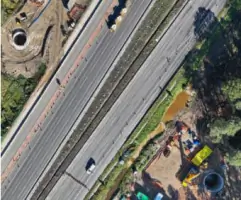
Our mobile mapping solutions enable efficient data collection for infrastructure and environmental projects. Using Trimble technology, we deliver high-accuracy spatial data for road networks, utilities, and urban planning. Clients benefit from rapid deployment, reduced field time, and seamless integration with existing workflows.
Data Preparation
We convert raw survey data into actionable formats for construction and rail projects. Services include CAD file conversion, surface layer creation, and Trimble Machine Control file preparation. Our expertise ensures compatibility with field software, enhancing project accuracy and reducing rework.
Consultancy
Our consultants provide end-to-end support for implementing geospatial technologies. From workflow design to system integration, we optimise Trimble solutions for surveying, construction, and utilities. Clients gain access to industry-specific insights and tailored strategies for operational efficiency.
Questions
What geospatial solutions does KOREC offer?
We provide GNSS systems, total stations, laser scanners, mobile mapping, and software platforms like Soarvo for surveying, construction, and utilities sectors.
Do you offer equipment hire services?
Yes, we hire surveying and mapping equipment with calibration, delivery options, and flexible rental periods across the UK and Ireland.
Are your services available outside the UK?
Our primary focus is the UK and Ireland, but we collaborate with international partners for select projects.
How can I access training programs?
Training is available via KOREC GeoSchool online, in-person courses, and bespoke sessions for teams across the UK and Ireland.
What accreditations do you hold?
We are ISO 9001, ISO 14001, and BSI-certified, with Trimble-accredited workshops for equipment servicing.
Videos