
Business Details
31 Years
experience
Expert Chartered Land Surveyors in Manchester
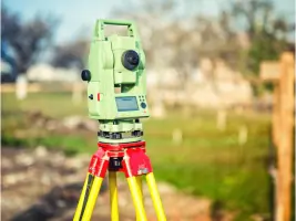
Established in 1995, N D Oliver has built a reputation as a trusted provider of advanced surveying solutions. Our team of 25 professionals, including eight with over 30 years' experience, utilises cutting-edge technology to deliver precise spatial data. Specialising in 3D laser scanning, topographic surveys, and measured building services, we serve diverse sectors across the UK. Our work adheres to rigorous quality standards underpinned by RICS regulation and Professional Indemnity insurance. With over 6,000 successfully completed projects, we combine technical expertise with client-focused service delivery.Our commitment to innovation is demonstrated through our adoption of the latest Total Station and GNSS technologies. Backed by a 25-year client retention record, we provide tailored solutions for complex surveying challenges. Our environmental policies ensure sustainable practices across all operations. As industry leaders, we maintain active RICS accreditation and continuously invest in staff development. Our Manchester-based team delivers consistent, high-quality outputs that meet exacting professional standards.

Services
3D Laser Scanning
Topographic Surveys
Measured Building Surveys
Boundary Surveys
CAD Services
BIM Modelling
Site Services
Utility Surveys
Legal Services
Monitoring Surveys
Details
- Year established: 1995
Highlights and features
- We listen to client requirements and provide tailored advice
- 30+ years' technical expertise in surveying solutions
- Over 6,000 successfully completed projects since 1995
- Regulated by the Royal Institution of Chartered Surveyors
- Continuously invest in latest surveying technology
Associations and certifications
- Royal Institution of Chartered Surveyors
Services
3D Laser Scanning
Our 3D laser scanning service captures precise spatial data using Leica and Faro equipment. We process pointcloud data with specialist software to create accurate 2D CAD plans and 3D BIM models. This technology enables detailed analysis of structures for deformation monitoring and building information modelling.
Topographic Surveys
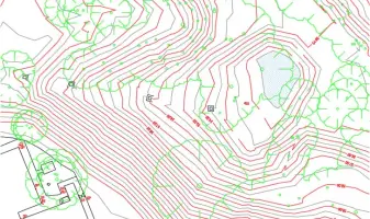
We conduct topographic surveys using GPS and total station technology to map land features and elevations. Our deliverables include contour plans, terrain models, and volume calculations for construction and infrastructure projects. All surveys can be referenced to Ordnance Survey grid systems.
Measured Building Surveys
Our measured building surveys produce detailed floor plans, elevations, and sections using traditional and laser scanning methods. We create accurate CAD drawings and Revit models for property management, renovation, and heritage recording applications.
Monitoring Surveys
We specialise in structural monitoring for buildings and infrastructure. Our services include verticality checks, crack analysis, and cooling tower deformation monitoring using advanced surveying techniques. We provide comparative analysis between current and historical data.
Boundary Surveys
Our boundary surveys determine legal property boundaries using registered title documents. We produce accurate plans for land registration, resolve boundary disputes, and provide survey data for property transactions and development projects.
Questions
What surveying services do you offer?
We provide 3D laser scanning, topographic surveys, measured building surveys, boundary determination, monitoring services, and BIM modelling. Our full list includes over 15 specialist surveying solutions.
Are you accredited by professional institutions?
Yes, we are regulated by the Royal Institution of Chartered Surveyors (RICS) and maintain Professional Indemnity insurance for all our surveying work.
How experienced is your team?
Our 25-strong team includes surveyors with over 30 years' experience. Eight staff members have worked with the company since its founding in 1995.
What areas do you cover?
While based in Manchester, we operate throughout the UK and have completed projects internationally, particularly for power station structure monitoring.
Can you handle large-scale projects?
With over 6,000 completed projects since 1995, we have extensive experience managing large-scale surveys including industrial estates, shopping centres, and infrastructure monitoring.