Business Details
50 Years
experience
Expert Surveyors in Leeds
Met Consulting Engineers offers integrated assessment, investigation, and design services through a team of over 40 qualified surveyors. Established in 1976, we serve public and private sector clients nationally, delivering accurate data and design solutions alongside compliance and efficiency support. Our Met AID framework combines desktop assessments, field investigations, and tailored design solutions to address project-specific challenges. We adhere to British and European Standards, maintaining accreditations through membership in surveying, geophysics, and utility survey bodies.Continuous investment in technology and training ensures market-leading expertise, supported by Employers, Public Liability, and Professional Indemnity Insurance. Our directors contribute to industry standards development, including PAS128 for underground utility detection. With a focus on health and safety and environmental protection, we provide diverse in-house expertise, joined-up thinking, and a tailored service across 40+ employees.

Services
Utility Mapping
Geophysics
Land Surveys
Measured Building Surveys
Drone Surveys
Drainage Surveys
Culvert Investigations
GPR Surveys
Environmental Geophysics
Archaeological Geophysics
Details
- Year established: 1976
Highlights and features
- We have over 40 qualified surveyors with expertise in utility mapping and geophysics.
- Our team contributed to the development of PAS128 underground utility standards.
- We maintain Cyber Essentials certification for digital security compliance.
- Our integrated Met AID framework ensures tailored solutions for every project.
- 40+ years of experience delivering nationwide surveying and engineering services.
Associations and certifications
- British Standards Institute
- Cyber Essentials
Services
Utility Mapping
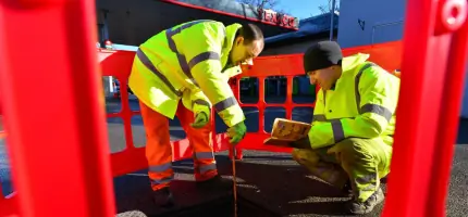
Our utility mapping services identify underground infrastructure using electromagnetic locators, ground penetrating radar, and CCTV inspections. We follow PAS128 standards to deliver precise CAD models and reports for safe project planning. This service supports infrastructure development, redevelopment projects, and compliance requirements across public and private sectors.
Geophysics
Geophysical surveys detect subsurface features using non-invasive techniques like ground penetrating radar and magnetometry. We apply these methods for archaeological investigations, environmental assessments, and hazard detection. Our expertise includes void location, rebar mapping, and landfill characterisation for engineering and environmental projects.
Land Surveys
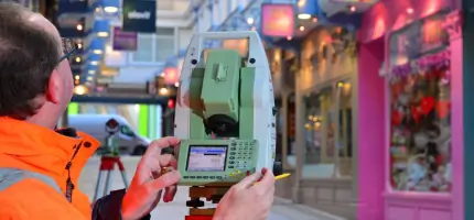
Topographical surveys create detailed site maps showing terrain features and existing structures. We use total stations and GPS to capture accurate data for planning applications, infrastructure projects, and heritage conservation. This forms the foundation for engineering designs and development proposals.
Measured Building Surveys
Measured building surveys produce precise architectural drawings of existing structures. We combine laser scanning and traditional techniques to create floor plans, elevations, and 3D models. This service supports refurbishment projects, heritage conservation, and asset management requirements.
Drainage Surveys
Drainage surveys map and assess surface and subsurface drainage systems using CCTV inspections and flow monitoring. We provide condition reports and design proposals for drainage improvements. This service supports flood risk assessments, planning applications, and infrastructure maintenance programmes.
Questions
What surveying services do you offer?
We provide utility mapping, geophysics, topographical surveys, measured building surveys, and drainage assessments across the UK.
Are you accredited to industry standards?
Yes, we follow PAS128 standards and maintain Cyber Essentials certification for digital security compliance.
How do you handle complex infrastructure projects?
Our Met AID framework combines desktop studies, field investigations, and tailored design solutions for infrastructure challenges.
Can you support heritage conservation projects?
Yes, we provide topographical surveys, measured building documentation, and geophysical investigations for heritage sites.
What experience do you have in utility detection?
Our team contributed to PAS128 standard development and uses advanced GPR and electromagnetic techniques for utility mapping.