Business Details
37 Years
experience
Expert Surveying Services Across the UK
Established in 1989, RGI Surveys has built a reputation for delivering precise and reliable surveying solutions across the UK. Our ISO 9001 accreditation underscores our commitment to quality management systems, ensuring every project meets rigorous standards through regular audits and equipment calibration. With over three decades of experience, our multidisciplinary teams specialise in topographic surveys, measured building surveys, and utility surveys, utilising cutting-edge technology to produce 2D and 3D deliverables in formats such as AutoCAD and Revit.We prioritise client satisfaction by minimising site visits through integrated survey teams, offering cost-effective solutions tailored to engineers, accountants, and buyers. Our approach combines technical expertise with adaptive risk assessment protocols, enabling safe site operations while maintaining compliance with evolving health and safety legislation. As a Midlands-based company strategically positioned within the UK motorway network, we provide nationwide coverage for both above-ground and subsurface survey requirements.
Services
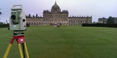
Topographic Surveys
Measured Building Surveys
Utility Surveys
3D Mapping
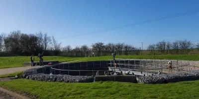
Underground Services Surveys
Details
- Year established: 1989
Highlights and features
- We have over 30 years of experience in land and utility surveying
- Our ISO 9001 accreditation ensures rigorous quality control standards
- Multidisciplinary teams reduce site visits and associated costs
- Nationwide coverage supported by Midlands-based strategic operations
- Dynamic risk assessment protocols ensure safe site operations
Associations and certifications
- ISO 9001
Services
Topographic Surveys
Our topographic surveys utilise advanced technology to create detailed terrain models and contour plans. These surveys support construction and development projects by providing accurate elevation data and surface features. Clients benefit from our multidisciplinary approach which integrates multiple survey types during single site visits.
Measured Building Surveys
Measured building surveys produce precise architectural drawings and 3D Revit models of existing structures. Our quality management system ensures deliverables meet ISO 9001 standards through regular equipment calibration and audit processes. This service supports renovation and asset management requirements.
Utility Surveys
Utility surveys map subsurface infrastructure using ground-penetrating radar and electromagnetic detection. This service identifies buried services to enhance site safety and inform construction planning. Our expertise addresses increasing legislative requirements for underground utility information.
3D Mapping
3D mapping services convert survey data into digital models compatible with AutoCAD and Revit platforms. This technology supports BIM integration and asset management systems. Our multidisciplinary teams ensure comprehensive data capture during single site visits.
Underground Services Surveys
Subsurface surveys locate and map buried utilities including drainage systems and service cables. This critical information supports safe excavation practices and infrastructure planning. Our equipment and expertise address complex underground service environments.
Questions
What survey types do you offer?
We provide topographic surveys, measured building surveys, and utility surveys using 3D mapping technology.
Are you ISO accredited?
Yes, we hold ISO 9001 accreditation for our quality management systems.
Do you operate nationwide?
Based in the Midlands, we offer survey services across the entire UK.
How do you ensure survey accuracy?
Through regular equipment calibration, quality audits, and ISO 9001 compliance.
Can you handle complex sites?
Our multidisciplinary teams adapt to site requirements, combining multiple survey types as needed.