
Business Details
22 Years
experience
Professional Surveying Services in Leeds
Established in 2004, CT Surveys has built a reputation as a trusted provider of comprehensive surveying solutions across the UK. Our expertise spans topographic and underground utility surveys, measured building surveys, laser scanning, BIM modelling, and drone surveys, supported by advanced technologies like GPS RTK SmartRovers and laser scanning equipment. With over two decades of combined experience in the field, our team delivers precise, high-quality deliverables tailored to clients' needs, serving private individuals, property developers, architects, and construction specialists.We prioritise accuracy, clarity, and client satisfaction, offering competitive pricing and nationwide coverage, including Yorkshire, Lancashire, the North East, and London. Our commitment to innovation and technical excellence ensures clients receive reliable data to reduce project risks and streamline planning processes.
Services
Topographic Surveys
Laser Scanning
BIM Modelling
Drone Surveys
Underground Utility Mapping
Measured Building Surveys
GPS Surveys
3D Modelling
Rights Of Light Surveys
Scanner Hire
Details
- Year established: 2004
Highlights and features
- We have over 20 years of experience in professional surveying services.
- Our team utilises advanced GPS RTK SmartRovers and laser scanning technology.
- We offer competitive pricing without compromising on quality or accuracy.
- Our services cover the entire UK, including remote and challenging locations.
- We provide tailored solutions for architects, developers, and construction specialists.
Services
Topographic Surveys
Our topographic surveys provide detailed terrain maps using GPS RTK SmartRovers and traditional methods. These surveys support construction, planning, and flood risk assessments by capturing accurate elevation data and surface features. Clients benefit from precise base plans to inform project designs and mitigate risks.
Laser Scanning
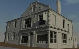
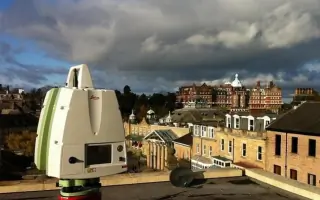
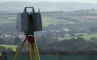
Laser scanning captures high-resolution 3D data for buildings, infrastructure, and complex structures. This technology enables rapid data collection with millimetre accuracy, ideal for heritage sites, industrial facilities, and BIM integration. Clients receive comprehensive point clouds and models to support renovation or analysis.
BIM Modelling
BIM modelling transforms survey data into intelligent 3D environments for construction projects. Using laser-scanned point clouds, we create detailed Revit models that enhance collaboration and project planning. This service ensures accurate as-built documentation and streamlines design workflows for architects and engineers.
Drone Surveys
Drone surveys collect aerial data for inaccessible or large-scale sites, complementing ground-based techniques. Our qualified pilots capture high-resolution imagery and LiDAR data to generate topographic maps, volumetric calculations, and 3D models. This approach reduces site visits and accelerates data acquisition for clients.
Underground Utility Mapping
Underground utility mapping identifies buried services using electromagnetic and GPR techniques. This service prevents excavation risks by locating pipes, cables, and ducts with high precision. Clients gain confidence in site safety compliance and avoid costly utility strikes during construction projects.
People
Chris Tutin
Director
Chris Tutin has worked as a professional surveyor since 1998, leading CT Surveys since its establishment in 2004. His expertise in measured surveys and laser scanning ensures clients receive accurate, innovative solutions for complex projects across the UK.
Questions
What surveying services do you offer?
We provide topographic surveys, laser scanning, BIM modelling, drone surveys, underground utility mapping, and measured building surveys tailored to your project requirements.
Do you operate outside Yorkshire?
Yes, we work nationwide, including London, Southern England, South Wales, the Isle Of Man, and Northern Scotland.
How experienced is your team?
Our team has over 20 years of combined experience in surveying, with expertise in advanced technologies like GPS RTK SmartRovers and laser scanning.
Can you handle large commercial projects?
Yes, we cater to both small private developments and large-scale commercial projects, delivering precise data to meet industry standards.
How do you ensure survey accuracy?
We use cutting-edge equipment like GPS RTK SmartRovers and laser scanners, combined with rigorous quality checks on all deliverables.
How can I request a quote?
Contact us via email at [email protected] or call 0113 44 00 435 to discuss your project and receive a tailored quote.