
Business Details
Aerial Photography Services for Business in Northern UK
At Airfotos, we specialise in delivering high-quality aerial photography tailored to meet the needs of commercial and industrial clients across Northern England. Our unique approach combines advanced aerial imaging techniques with the use of a Cessna 172 aircraft, ensuring safe and stable platforms for capturing detailed site overviews. With extensive experience in aviation and photography, our team provides bespoke solutions for construction monitoring, property marketing, and event coverage. Clients benefit from our ability to showcase sites within their geographical context, offering insights that ground-level photography cannot achieve. We maintain a vast library of over 500,000 images, providing cost-effective options for businesses seeking professional visual documentation.Our services extend to repeat survey packages, enabling clients to track progress on large-scale developments efficiently. Approved for operations over crowded and sensitive areas, we deliver perspectives that drone services often cannot match. Trusted by organisations like the Port of Sunderland and Frew Pain & Partners, our work consistently demonstrates technical expertise and reliability. We prioritise clear communication, offering prompt assistance through direct calls, emails, or our online contact form. Committed to innovation, we continuously refine our methods to ensure clients receive the highest standard of aerial imaging solutions.
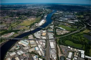
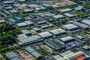
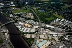
Services
Progress Photography
Land Development Imaging
Commercial Property Aerials
Event Coverage
Construction Monitoring
Aerial Context Mapping
Highlights and features
- We operate a Cessna 172 aircraft for stable, high-quality aerial imaging platforms
- Our team combines aviation expertise with professional photography skills
- Approved to capture images over crowded areas where drones cannot operate
- Access to over 500,000 archived images for cost-effective solutions
- Repeat survey packages available for construction progress monitoring
What people say
High quality aerial images
Cost effective professional way
Highlight key features
Showcase development scale
Reliable progress monitoring
Services
Progress Photography
Commission us to document ongoing construction projects through aerial overflights. We offer repeat surveys over time to track development progress, providing comprehensive visual records that ground-level photography cannot achieve. Clients receive high-resolution images capturing every stage of their project.
Commercial Property Imaging
Capture compelling aerial perspectives of properties for sale or lease. Our imagery highlights location context, surrounding amenities, and site potential through detailed overhead shots. Real estate professionals use these images to create more effective marketing materials that showcase properties in their best light.
Event Coverage
Document large-scale events with our specialised aerial photography services. Approved for operations over crowded areas, we capture unique overhead views that demonstrate event scale and attendance. Our images provide valuable promotional material while showcasing spatial relationships that ground cameras cannot replicate.
Land Development Imaging
Provide comprehensive aerial surveys of land parcels and their surroundings. Our imaging solutions show properties within their geographical context, helping clients with planning applications, environmental assessments, and development proposals through detailed overhead documentation.
People
Jonathan Rasmussen
Mission Specialist
Qualified pilot and professional photographer with extensive experience in general aviation and business jet operations. Specialises in capturing precise aerial imagery for commercial applications.
Chelsea Richards
Admin & Accounts
Aviation industry professional managing administrative operations and client communications. Provides expert support for commission requests and image library inquiries.
Questions
What areas do you cover for aerial photography services?
We primarily serve Northern England, including Newcastle upon Tyne, Sunderland, and County Durham, with capabilities extending across the broader region.
Can you provide images of existing sites or developments?
Yes, our library contains over 500,000 archived images available for immediate purchase at £165 per image.
How do commissioned aerial surveys work?
Our custom surveys start at £395, capturing 30-40 ultra-high-quality images from multiple angles. We accommodate specific instructions to ensure optimal shot composition.
What makes your services different from drone operators?
Our Cessna 172 aircraft provides superior stability for imaging, and we hold approvals for operations over crowded areas where most drones cannot legally fly.
How quickly can you complete a commissioned flight?
We maintain no waiting list - survey flights are conducted at the earliest opportunity following commission confirmation.
